| |
|
Previous: Night Flight |
|
| |
|
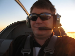
12/25/2006 - Flying Report
I was looking at the website the other day and I realized that I hadn't updated it in quite a while. It's not that I haven't been doing anything with the plane, it's just that I started working on the RV-10 and I've been putting my web editing efforts on the new website.
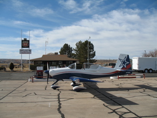
The RV-9A has been working perfectly and I have over 110 hours on it so far. As such, I have some observations about the plane that I'll go ahead and share with you. |
 |
| |
|
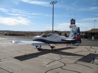
This is being written on Christmas day, about a week after returning from my longest cross-country flight so far. I flew from McKinney (TKI) to Burbank (WHP) for a business trip. I did this because I wanted to show the plane to some friends, but also just because I could. I had the free time to be flexible with my travel plans, and the weather was really perfect for a flight like this, so I took the opportunity and had a great time flying out west.
I departed TKI at just before 7am on Tuesday morning. Interestingly, this turned out to be the one glitch of the trip. |
 |
| |
|
The airport was absolutely devoid of any activity. After starting the engine, I switched the radio to ground and called for clearance to taxi. No response, so I switched to the tower frequency. Again, no response, so I assumed that the tower must not yet be operational. I began to taxi, but before I reached the threshold for the taxiway I looked back at the tower to see if there was anyone inside. Hey, there's a red light gun. I guess there is someone there. Oops, my volume control was turned down. After adjusting the volume I was able to get clearance to taxi. |
 |
| |
|
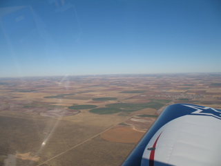
My first stop was Plainview, TX, which is just north of Lubbock. Fuel was cheap at $2.99 per gallon. It only took about 10 minutes to fill up, pay, and take a bathroom break before I was back in the air headed further west than I had ever flown.
Lubbock is at about 3000 feet elevation, and I had planned to fly at 10,500 to take advantage of the thinner air and hopefully avoid the terrain. I've never flown anywhere that I have needed to worry about terrain, so I figured I'd just go over it. |
 |
| |
|
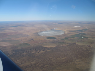
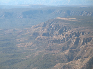
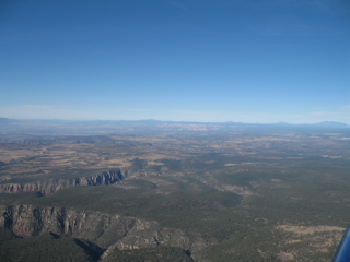
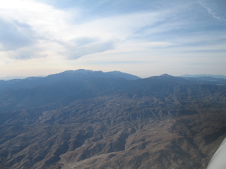
As I passed into New Mexico, I noticed some frozen lakes. here and there. It didn't even seem that cold. The OAT showed about 38 degrees. I could also see some mountains in the distance.
The main problem at this point in the trip is that there is a horrendous headwind keeping my ground speed at about 150mph. I guess I'm spoiled to cruising along in the 170-180 mph range. If I were flying a Cessna 150, I'd be going slower than the cars. Instead I am still making good time, just not as good as I'd like. |
 |
| |
|
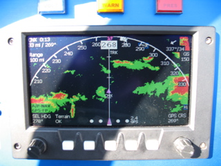
Remember a while back when I wrote about installing the terrain feature in the EFIS? This is the first time I've actually seen it in action. It's so cool that I took a picture of it. Now granted, I have about 100 miles of visibility, and I'm flying at about 10,500 feet, so there's no chance I'm going to run into any mountains, but it was reassuring to be able to see the peaks graphically and know that I wouldn't have any trouble clearing them. |
 |
| |
|
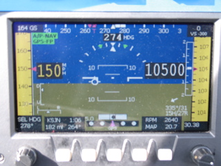
Switching back to the PFD display, let me explain a bit of the information. I'm at 10,500 feet. I'm climbing just a bit. The indicated airspeed is 150 mph. In the top left corner is the ground speed. It shows that I am doing 164 mph over the ground. Why so slow? If you look in the lower right corner you will see a white arrow showing the wind direction. Right now it's blowing from 335° at 31 knots. Fortunately it's more crosswind than direct headwind. You can see the "pipper" just left of the center of the screen. It shows that I am flying at a crab to account for the crosswind. |
 |
| |
|
A few more bits of information on the above screen: It shows that my RPM is 2640 and a manifold pressure of 20.7". My destination is KSJN, which is a little more than one hour away at my current speed. There's really a lot of information on this display.
Now is also a good time to mention that the autopilot is currently following the flight plan that I have entered into the Garmin 496 and that has been downloaded to the GRT EFIS. I don't have a pitch autopilot installed, so I am constantly monitoring the little vertical speed bar next to the altitude display. |
 |
| |
|
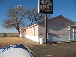
My second stop was in St. Johns, Arizona (SJN). This airport (and the city) is at 5700 feet elevation. The takeoff and landing was a bit different than I'm used to, but not too bad because of the cool weather. I'm sure if it was hot, and if I was fully loaded, it would have been much more of an adventure. The 160hp is really plenty of power for this plane, but this is one situation where a bit more power might come in handy. It also is worth noting that a constant speed propeller would really be nice. My prop is pitched for cruise, and I could use a bit more "climb" out here. |
 |
| |
|
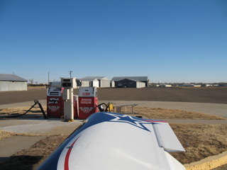
With no real oil consumption to speak of, and with everything in the plane basically brand new, there's not much to do but put fuel in the plane and go. Nonetheless I took the time to double-check the oil level and the other preflight items before resuming my flight. Most importantly, I had to clean the windshield.
Up until now I'm feeling pretty good about the trip. I'm thinking that I'm more than halfway to my destination. The plane was performing perfectly, and even with the headwind I was on schedule. |
 |
| |
|
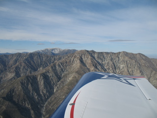
Normally when I fly cross country I spend a certain amount of my "idle" time locating possible landing sites in case of an emergency. I have done this since my flight training, and I consider it prudent when flying, especially when crossing unfamiliar territory.
Imagine my dismay when I realize that there are really no good options while crossing these mountain ranges. My only margin of safety was the altitude at which I was cruising. I had determined that at a 12 to 1 glide ratio, I could glide for no more than 15 miles if I had an engine failure. |
 |
| |
|
This turned out to be an unnecessary exercise as the o-320 continued to purr away hour after hour without so much as a cough.
Another item to note is that on any cross-country, I ask for VFR flight following. It's nice to feel like there's someone watching my progress and if I have an emergency I am already on a valid frequency to talk to someone right away. The workload is increased a bit as I am handed off from one controller to the next, but it's a welcome task. |
 |
| |
|
Now I'm in California and the EFIS and GPS are telling me that my destination is getting closer.
The Garmin 496 is one of my favorite flying tools. The aviation weather has been helpful not only for avoiding bad weather, but also for knowing the wind speeds at different altitudes. It is also nice to be able to see the weather at my destination while I'm still hours away. It gives me a tremendous amount of situational awareness. |
 |
| |
|
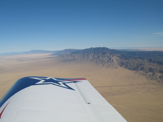
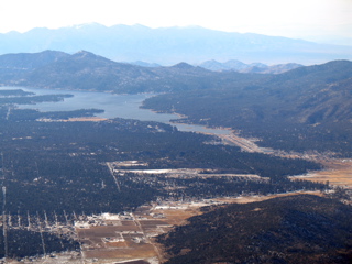
I flew over Twenty Nine Palms and then over Big Bear. I had intended to stop at Big Bear before descending into the LA area, but I had plenty of fuel and I was ready to be at my destination, so I flew over and kept going.
After crossing over the mountains, I descended to 8500 feet and continued to stay near the hills and out of the congested airspace of the LA area. I continued to work my way west, being handed off more rapidly from one controller to the next. |
 |
| |
|
When I finally got near Whiteman, the controller said something like "follow the 170 freeway and contact tower on xxx." I had no idea which highway was which, but I was quickly approaching the Class D airspace of Whiteman, so I switched to tower and tried to give them my location as best I could. Also, in addition to being unfamiliar with the highway system, I also came to realize that there are hills in my way. The airport was on the other side of a big hill. that was above the approach altiude. Fortunately, there was another plane in the pattern so I was able to follow the traffic and the rest of the arrival went without problem. |
 |
| |
|
When I landed, the tower asks me "Hey, is that the Dallas Cowboys team plane?" I said that I couldn't fit the whole team in the plane. The controller says "You probably couldn't fit TO's ego in there." So, I've arrived at my destination and the controllers are friendly and helpful, so I'm feeling really great.
I had my business meetings and enjoyed showing my plane to my LA buddies, but I was ready to get home. I chose to fly the opposite route on the way home, but because of the tailwinds, I was able to make the return trip with only one fuel stop. |
 |
| |
|
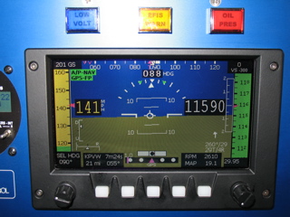
Check this out. Here is the PFD display as I fly home. I'm at 11,590 feet with a nice 29 knot tailwind. This gives me a ground speed of between 200 and 210 mph. That's more like it. The fuel burn is being constantly calculated by the EFIS, and I am able to determine that I will have no problems making my destination with an hour of reserves.
|
 |
| |
|
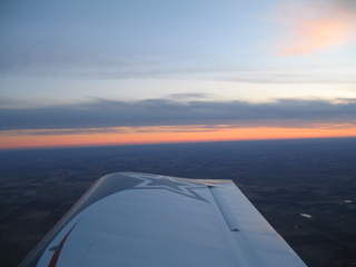
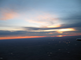
As the sun disappeared over the horizon behind me, I turned on my LED position lights. These things have worked great so far. The strobes have been on the entire trip, and have worked great as well.
My landing at McKinney was perfect, and aside from being sore from the 7 hour flight, I was thrilled to have made the trip.
|
 |
| |
|
There were three things that I learned about the plane during this trip. First, I need more comfortable seats. Second, it would really be great to have an altitude hold autopilot. Finally, I have determined that I need to get my instrument rating.
I have ordered a pair of leather Aviator seats from Classic Aero Designs. We'll see if these add the level of comfort I need. |
 |